
Program Resources
- Current State Forest Management Plans
-
Driving Directions Brochure
[
 258.7 kB
]
258.7 kB
]
-
Four Wheel Drive Know Before You Go Brochure
[
288.3 kB
]
-
History of Withlacoochee State Forest
[
16.7 MB
]
- Photos of Withlacoochee State Forest
- Trailtrotter Program
- Trailwalker Hiking Program
-
Withlacoochee State Forest Brochure
[
970.2 kB
]
-
Withlacoochee State Forest in a Nutshell Brochure
[
625.7 kB
]
-
Withlacoochee State Forest Management Plan
[
696.9 kB
]
Maps:
Smart device mapping is possible and encouraged in the state forests. Before visiting a forest, search for “PDF Maps” in the app store to find an app that works for you and download our state forest map, which is georeferenced.
-
Withlacoochee State Forest Map
[
2 MB
]
-
Annutteliga Hammock Brochure
[
316.2 kB
]
-
Citrus Hiking Trails Brochure
[
738.5 kB
]
-
Citrus Horse Trail Brochure
[
569.6 kB
]
-
Croom River Hiking Tract
[
269 kB
]
-
Croom Tract Hiking Trails
[
361.4 kB
]
-
Croom Horse Trail Brochure
[
979.6 kB
]
-
Croom Motorcycle Area Buttgenbach Mine Campground Brochure
[
799.1 kB
]
-
Croom Off-Road Bicycle Trail Brochure
[
451.5 kB
]
-
Croom River Trail Brochure
[
557.3 kB
]
-
Homosassa Tract
[
365.4 kB
]
-
Homosassa Tract Brochure
[
367 kB
]
-
Little River Multi-Use Trail Brochure
[
334.4 kB
]
-
Little River Multi-Use Trail Map
[
280.2 kB
]
-
McKethan Lake Day Use Area Brochure
[
403.4 kB
]
-
Richloam Hiking Trail Brochure
[
731.3 kB
]
-
Silver Lake Brochure
[
599.6 kB
]
-
Silver Lake Complex
[
224.1 kB
]
-
Two Mile Prairie Brochure
[
968.8 kB
]
-
Two Mile Prairie Tract Map
[
203.5 kB
]
-
Withlacoochee Canoe Trail
[
41.5 kB
]
-
Withlacoochee Croom Hike and Bike Trails
[
636.5 kB
]
-
Annutteliga Hammock Brochure
[

The Florida National Scenic Trail passes through the forest.

Withlacoochee State Forest is part of the Great Florida Birding Trail.
Recreation Areas on the Croom Tract at Withlacoochee State Forest
The Croom Tract at Withlacoochee State Forest, located in Hernando and Sumter counties, has more than 20,000 acres of cypress and longleaf pine forests and includes 13 winding miles of the Withlacoochee River, which reaches its widest expanse and forms Silver Lake, a prime recreation spot.
Recreation Areas on the Croom Tract:
Croom Motorcycle Area | East Croom | Hog Island | Iron Bridge | River Junction | Silver Lake | Tucker Hill
East Croom Hunt Camp/Equestrian Trailhead
The trailhead has a parking area for equestrians. The trailhead is CLOSED during hunting season.
Primitive hunt camp is open only during hunting season by permit only and for camping use by licensed hunters only.
Features
- Horseback riding
Facilities
- None
Trails
- Equestrian trails:
-
Hernando Main Loop
[
979.6 kB
]
is 18.65 miles.
-
Hernando Total
[
979.6 kB
]
is 36.35 miles
-
Sumter Total
[
979.6 kB
]
is 7.7 miles.
-
Hernando Main Loop
[
Note: ALL horses must have proof of current negative Coggins test results when on state lands. ALL children under the age of 16 are required to wear a protective helmet while riding on state lands.
Hog Island Recreation Area
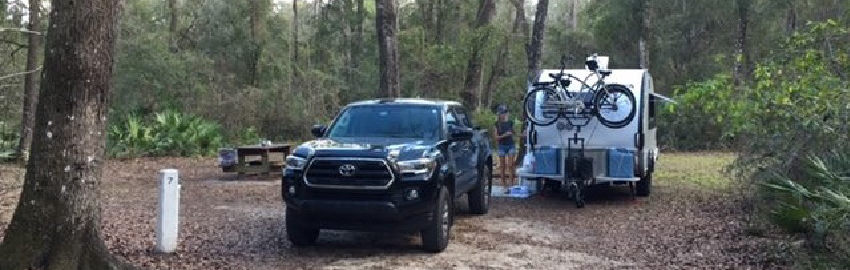
Hog Island Recreation Area is located on the east bank of the Withlacoochee River near the community of Nobleton, Florida, and includes the Hog Island Nature Trail, which is part of the Trailwalker Program.
The Hog Island Campground has beautiful shaded campsites that are screened from one another by natural understory vegetation. The campsites have access to the Withlacoochee River.
Features
- Canoeing
- Fishing
- Hiking
- Picnicking
- No pets allowed
Facilities
- Group camp for organized youth groups requires a reservation. For information and reservations, visit Reserve America or call 1-877-879-3859.
- Primitive campsites with water, picnic table and fire ring with a grate and/or a grill. Campsite with water is available near the river for campers arriving by canoe. For information and reservations, visit Reserve America or call 1-877-879-3859.
- Canoe and boat launch
- Dump station
- Picnic area
- Restrooms and showers
Trails
- Hiking trails: Nature Trail is a 2-mile loop; River Trail/Sumter is 7.2 miles.
Address
9274 County Road 635 (Forest Road 13), Bushnell, FL 33513
Directions
From I-75, take Exit 309 to C-476. Turn left and head west to the intersection with County Road 635. Turn left and follow south to Hog Island Recreation Area.
Iron Bridge Day Use Area
The hiking trail provides a good turn-around point for less experienced hikers who start their hike from either Hog Island or River Junction.
Features
- Canoeing
- Fishing
- Hiking
- Picnicking
- No pets allowed
Facilities
- Canoe and kayak launch
- Parking
- Picnic area
Trails
- Canoe trail
- Hiking trail
Address
11050 SW 60th Street (Forest Road 13), Webster, FL 33597
Directions
From I-75, take Exit 309. At stop sign on off-ramp, turn left and head a short distance to the "Welcome to the Withlacoochee State Forest" sign at SW 62nd Way (Forest Road 17). Turn left onto forest and continue 0.75 miles to intersection with signage. Turn right on SW 60th Street (Forest Road 13) and continue 1/3 mile to entrance to Iron Bridge Recreation Area on the left.
River Junction Recreation Area
This recreation area provides many opportunities for canoe and fishing enthusiasts. The River Junction Campground is located at the junction of the Little Withlacoochee River and the Withlacoochee River at the southern end of Silver Lake.
Features
- Canoeing
- Fishing
- Hiking
- Picnicking
- No pets allowed
Facilities
- Boat and canoe launch
- Primitive campsites with water, picnic table and fire ring with a grate and/or a grill. For information and reservations, visit Reserve America or call 1-877-879-3859.
- Restrooms and showers
Trails
- Canoe trail
- Hiking trail
Address
5827 SW 121st Avenue (Forest Road 13), Webster, FL 33597
Directions
Please follow directions below and DO NOT FOLLOW GPS or other mapping applications or you may be directed somewhere besides River Junction Campground and Recreation Area.
From I-75, take Exit 301 (Brooksville). Head east on State Road 50/U.S. Highway 98 to U.S. Highway 301. Turn left (north) and continue 5 miles to County Road 656 (Croom-a-Coochee Road and Yellow Flashing Traffic Light). Turn left (west) on County Road 656 and continue 2 miles past SW 50th Boulevard. Continue west 1/5 mile to the "Welcome to the Withlacoochee State Forest" sign. Turn left and continue approximately 1 mile to SW 121st Avenue and the entrance to River Junction Campground and Recreation Area on left. These directions include travel on 1. 5 miles of limerock forest road.
OR
From I-75, take Exit 309 (Webster). At stop sign on off-ramp, turn left and head short distance to the "Welcome to the Withlacoochee State Forest" sign at SW 62nd Way (Forest Road 17). Turn left onto forest and continue ¾ mile to intersection with signage. Turn left on SW 60th Street (Forest Road 13, which turns into SW 50th Way) and continue 2 miles to SW 121st Avenue to entrance to River Junction Campground and Recreation Area on right. These directions include travel on 2.3 miles of limerock forest road.
Silver Lake Recreation Area Complex
The Silver Lake Recreation Complex is approximately 6 miles down river from Hog Island Recreation Area and 10 miles from the Nobleton boat ramp/canoe launch sites at the C-476 (Lake Lindsey Road) river bridge and the community park located on the north side of C-476 at the northern terminus of Edgewater Avenue.
Address
31475 Silver Lake Road, Brooksville, FL 34602
Directions
Take I-75 Exit 301 to U.S. 98/State Road 50. Turn east (away from Brooksville) and proceed about 1 mile until you reach the stoplight at Croom Rital Road. Turn left and proceed north for approximately 3 miles on Croom Rital Road. Follow signs to the Withlacoochee State Forest Silver Lake Recreation Area.
Silver Lake Day Use Area
This is a fee area and the $2 per person day use fee applies to all day users including those with a pavilion reservation. To pay the day use fee, visit the Web Store at Reserve America on the day of your visit.
Features
- Boating, canoeing, kayaking
- Fishing
- Hiking
- Jet skiing
- Picnicking
- Leashed pets allowed
Facilities
- Boat ramp/canoe launch
- Pavilion. For information and reservations, visit Reserve America or call 1-877-879-3859.
Trails
- Canoe trail
- Hiking trails: Croom Loop Trails (30+ miles), River Trail/Hernando (7 linear miles), nearby access to the paved multi-use Withlacoochee State Trail (46 miles) and Good Neighbor Trail to Brooksville (10 miles)
Directions
Take I-75 Exit 301 to U.S. Highway 98/State Road 50. Turn east (away from Brooksville) and proceed about 1 mile until you reach the stoplight at Croom Rital Road. Turn left and proceed north on approximately 3 miles on Croom Rital Road. Follow signs to the Withlacoochee State Forest Silver Lake Recreation Area. Turn right onto Silver Lake Road and continue straight past gatehouse to Day Use Area and Boat Ramp.
Silver Lake Campground
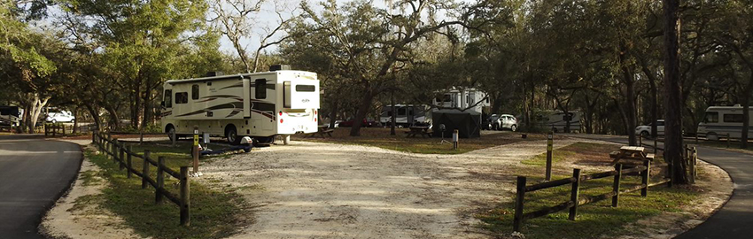
Campsites spread out under the open shade of large oak trees. The campground is located on the northern end of Silver Lake on a gently sloping grassy area, and many sites have a view of the water. A boat ramp is located in the campground. The campground is located adjacent to Interstate 75, so constant interstate noise can be expected.
Features
- Camping for RVs and tents
- Canoeing
- Fishing
- Leashed pets allowed
Facilities
- Boat ramp/canoe launch
- Developed campsites with electricity, water, picnic table and fire ring with a grate and/or a grill. For information and reservations, visit Reserve America or call 1-877-879-3859.
- Dump station located on main entrance/exit road for all three campgrounds on the left as you are exiting the facility
- Restrooms and showers
Trails
- Nature trail and boardwalk
Directions
Take I-75 Exit 301 to U.S. 98/State Road 50. Turn east (away from Brooksville) and proceed about 1 mile until you reach the stoplight at Croom Rital Road. Turn left and proceed north for approximately 3 miles on Croom Rital Road. Follow signs to the Withlacoochee State Forest Silver Lake Recreation Area. Turn right onto Silver Lake Road. After passing the gatehouse, follow the road to the right approximately ¼ mile to the first campground entrance to Silver Lake Campground on your left.
Cypress Glen Campground
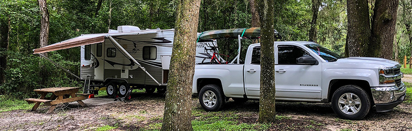
Campsites sit high above Silver Lake under the shade of oak and pine trees with several sites having a view of the water. Cypress Glen Campground is more wooded and quieter than Silver Lake Campground, with much less road noise from I-75.
Features
- Camping for RVs and tents
- Canoeing
- Fishing
- Leashed pets allowed
Facilities
- Developed campsites with electricity, water, picnic table and fire ring with a grate and/or a grill. For information and reservations, visit Reserve America or call 1-877-879-3859.
- Canoe launch
- Dump station located on main entrance/exit road for all three campgrounds on the left as you are exiting the facility.
- Restrooms and showers
Trails
- Canoe trail
- Nature trail and boardwalk
Directions
Take I-75 Exit 301 to U.S. Highway 98/State Road 50. Turn east (away from Brooksville) and proceed about 1 mile until you reach the stoplight at Croom Rital Road. Turn left and proceed north on approximately 3 miles on Croom Rital Road. Follow signs to the Withlacoochee State Forest Silver Lake Recreation Area. Turn right onto Silver Lake Road. After passing the gatehouse, follow the road to the right approximately 1 mile to the second campground entrance to Cypress Glen Campground on your left.
Crooked River Campground
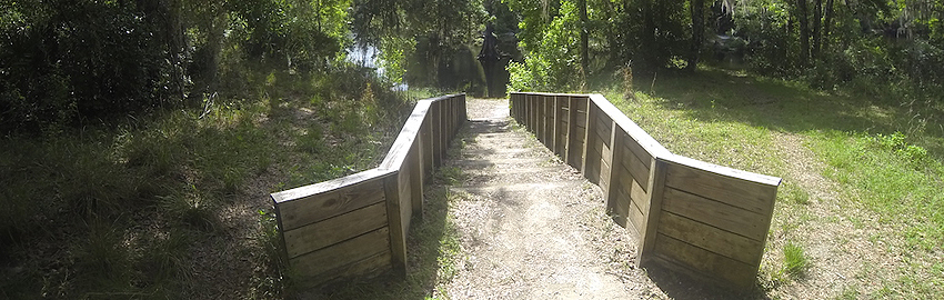
Crooked River Campground offers Old Florida-style camping at its best. Sites are surrounded by dense understory for more privacy. A staircase provides access to the Withlacoochee River, and a trail connector provides direct access for registered campers to the Florida National Scenic Trail and Withlacoochee State Trail right from the campground.
Features
- Fishing
- Hiking
- No pets allowed
Facilities
- Group camp for organized youth groups of 25 or less. For information and reservations, visit Reserve America or call 1-877-879-3859.
- Tent-only primitive campsites with water (no electric), a picnic table and fire ring with a grate and/or a grill. For information and reservations, visit Reserve America or call 1-877-879-3859.
- Restrooms and showers
Trails
- Canoe trail
- Hiking trail
Directions
Take I-75 Exit 301 to U.S. Highway 98/State Road 50. Turn east (away from Brooksville) and proceed about 1 mile until you reach the stoplight at Croom Rital Road. Turn left and proceed north on approximately 3 miles on Croom Rital Road. Follow signs to the Withlacoochee State Forest Silver Lake Recreation Area. Turn right onto Silver Lake Road. After passing the gatehouse, follow the road to the right approximately 2 miles to end of road to the third campground entrance to Crooked River Campground.
Tucker Hill Day Use Area
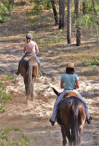
The Tucker Hill Day Use Area is located on the Hernando County side of the Croom Tract on Croom Road. Day use fee applies.
Features
- Biking
- Hiking
- Horseback riding
- Picnicking
- Leashed pets allowed
Facilities
- Bike wash
- Pavilion. For information and reservations, visit Reserve America or call 1-877-879-3859.
- Picnic area and double BBQ grill
- Restrooms
Trails
- Hiking trails: A Loop is 7.39 miles; B Loop is 8.97 miles; C Loop is 8.09 miles.
- Equestrian trails: Hernando Main Loop is 18.65 miles; Hernando Total is 36.35 miles; Sumter Total is 7.7 miles.
- Off-Road Bicycle Trails:
Blue Trail
[
310.4 kB
]
is 32 miles;
Red Connector Trails
[
310.4 kB
]
are 7 miles;
Yellow Trail
[
310.4 kB
]
is 12 miles.
Note: ALL horses must have proof of current negative Coggins test results when on state lands. ALL children under the age of 16 are required to wear a protective helmet while riding on state lands.
Address
26578 Croom Road (Forest Road 6), Brooksville, FL 34601
Directions
From Brooksville, head north on U.S. Highway 41 to Croom Road (C-480). Take a right and proceed east on Croom Road to trailhead.
Program Resources
- Current State Forest Management Plans
-
Driving Directions Brochure
[
258.7 kB
]
-
Four Wheel Drive Know Before You Go Brochure
[
288.3 kB
]
-
History of Withlacoochee State Forest
[
16.7 MB
]
- Photos of Withlacoochee State Forest
- Trailtrotter Program
- Trailwalker Hiking Program
-
Withlacoochee State Forest Brochure
[
970.2 kB
]
-
Withlacoochee State Forest in a Nutshell Brochure
[
625.7 kB
]
-
Withlacoochee State Forest Management Plan
[
696.9 kB
]
Maps:
Smart device mapping is possible and encouraged in the state forests. Before visiting a forest, search for “PDF Maps” in the app store to find an app that works for you and download our state forest map, which is georeferenced.
-
Withlacoochee State Forest Map
[
2 MB
]
-
Annutteliga Hammock Brochure
[
316.2 kB
]
-
Citrus Hiking Trails Brochure
[
738.5 kB
]
-
Citrus Horse Trail Brochure
[
569.6 kB
]
-
Croom River Hiking Tract
[
269 kB
]
-
Croom Tract Hiking Trails
[
361.4 kB
]
-
Croom Horse Trail Brochure
[
979.6 kB
]
-
Croom Motorcycle Area Buttgenbach Mine Campground Brochure
[
799.1 kB
]
-
Croom Off-Road Bicycle Trail Brochure
[
451.5 kB
]
-
Croom River Trail Brochure
[
557.3 kB
]
-
Homosassa Tract
[
365.4 kB
]
-
Homosassa Tract Brochure
[
367 kB
]
-
Little River Multi-Use Trail Brochure
[
334.4 kB
]
-
Little River Multi-Use Trail Map
[
280.2 kB
]
-
McKethan Lake Day Use Area Brochure
[
403.4 kB
]
-
Richloam Hiking Trail Brochure
[
731.3 kB
]
-
Silver Lake Brochure
[
599.6 kB
]
-
Silver Lake Complex
[
224.1 kB
]
-
Two Mile Prairie Brochure
[
968.8 kB
]
-
Two Mile Prairie Tract Map
[
203.5 kB
]
-
Withlacoochee Canoe Trail
[
41.5 kB
]
-
Withlacoochee Croom Hike and Bike Trails
[
636.5 kB
]
-
Annutteliga Hammock Brochure
[
The Florida National Scenic Trail passes through the forest.
Withlacoochee State Forest is part of the Great Florida Birding Trail.


