
Contact Us
Primary Contact:
Elizabeth Smith
(904) 406-6384
Elizabeth.Smith@FDACS.gov
Secondary Contact:
Justin Rogers
(904) 266-8361
Justin. Rogers@FDACS.gov
Jennings State Forest
1337 Long Horn Road
Middleburg, FL 32068

Recreation Areas at Jennings State Forest
Jennings State Forest has outstanding forest and water resources that offer a variety of recreational opportunities such as hiking, swimming (at your own risk), camping, canoeing, fishing, hunting, nature study, mountain biking and horseback riding.
See a map of Jennings State Forest
[
 361.3 kB
]
361.3 kB
]
Bootleggers Campground
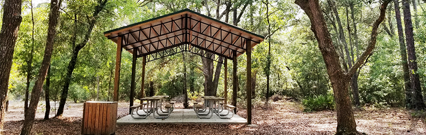
Take in the night sky and enjoy an evening in the real Florida with terrific stargazing. Access to Yellow Water Creek is available by foot a short distance from the campground. Bootleggers Campground offers eight drive-up primitive tent sites.
For camping information and reservations, visit FloridaStateForests.ReserveAmerica.com or call 1-877-879-3859.
Features
- Bicycling (prohibited on hiking trails)
- Hiking
- Picnicking (for registered campers only)
- Primitive tent camping only
- Leashed pets allowed
Facilities
- Grills and picnic tables
- Parking
- Pavilion
- Restrooms
Directions
From County Road 217, take Long Branch Road to Jennings State Forest entrance. Continue on Long Branch Road to Bootleggers Campground entrance on right, about 1/8 mile beyond the Nolan Ridge Church.
Ellis Ford Recreation Area
This recreation area allows the paddling enthusiast access to Black Creek at its northernmost accessible landing. Paddling from Ellis Ford to Knights Landing Recreation Area and Indian Ford Recreation Area can take approximately two to six hours with the possibility of an eight-to-10-hour paddle further into the town of Middleburg, Florida. Ellis Ford offers access to the Pioneer Trail. Swimming is not allowed at Ellis Ford.
Features
- Bicycling (prohibited on hiking trails)
- Canoeing/kayaking
- Hiking
- Hike-to camping
- Picnicking
- Leashed pets allowed
Facilities
- Chapman's Camp Zone located on Pioneer Trail (first come, first serve)
- Dunn's Camp Zone located on Pioneer Trail (first come, first serve)
- Parking
Directions
From County Road 218, take Nolan Road to Jennings State Forest entrance. Continue on Nolan Road to Ellis Ford Road and turn right. Ellis Ford Recreation Area is approximately 1.5 miles ahead.
Hammock Campground
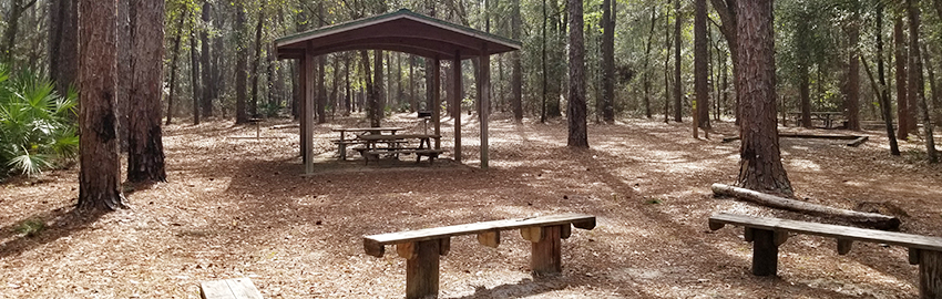
Named Hammock Campground because of its mature oaks and shaded canopy, this campground offers 10 drive-up primitive tent sites.
Hammock Campground is just a short drive from hiking and wildlife viewing. See map for details.
For camping information and reservations, visit FloridaStateForests.ReserveAmerica.com or call 1-877-879-3859.
Features
- Bicycling (prohibited on hiking trails)
- Hiking
- Picnicking (for registered campers only)
- Primitive tent camping only
- Leashed pets allowed
Facilities
- Grills and picnic tables
- Group campfire area with seating
- Parking
- Pavilion
- Restrooms
Directions
From State Road 21, take Old Jennings Road to Live Oak Lane and turn right. Follow Live Oak Lane to Jennings State Forest entrance. Continue straight for 1 mile and turn left on Bell Cemetery Road, following camping signs to Hammock Campground.
Indian Ford Recreation Area
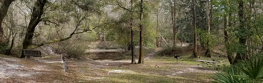
Indian Ford Recreation Area gives Jennings State Forest visitors access to the North Fork of Black Creek. Swimming is allowed. Additionally, this recreation area offers hiking as the southern terminus of the Pioneer Trail.
Features
- Bicycling (prohibited on hiking trails)
- Canoeing/kayaking
- Fishing
- Hiking
- Hike-to camping
- Picnicking
- Swimming (at your own risk)
- Leashed pets allowed
Facilities
- Bluff Camp Zone located on Pioneer Trail (first come, first serve)
- Grills and picnic tables
- Parking
Trail Maps
-
Pioneer Trail
[
361.3 kB
]
(Southern Terminus): 2.5-10 miles, moderate
Directions
From County Road 218, take Nolan Road to Hattie Nolan Road and turn right. Follow Hattie Nolan Road through Jennings State Forest entrance to Indian Ford Road at cemetery. Continue straight onto Indian Ford Road for approximately half a mile.
Knights Landing Recreation Area
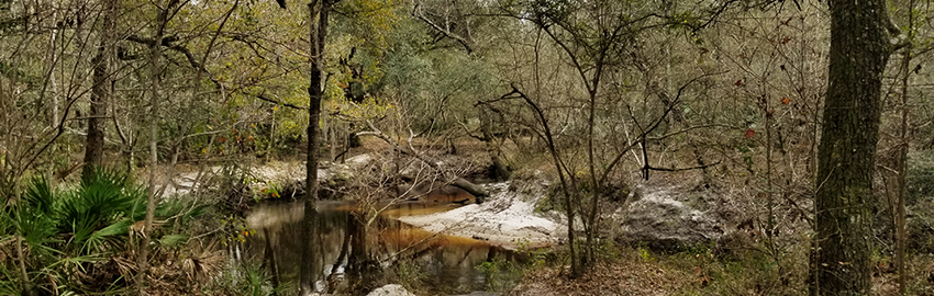
Knights Landing Recreation Area provides access to the North Fork of Black Creek for swimming and paddling. Hikers can access the Pioneer Trail at its second point approximately 2.5 miles north of Indian Ford.
Features
- Bicycling (prohibited on hiking trails)
- Canoeing/kayaking
- Hiking
- Hike-to camping
- Swimming (at your own risk)
- Leashed pets allowed
Facilities
- Bluff Camp Zone located on Pioneer Trail (first come, first serve)
- Chapman's Camp Zone located on Pioneer Trail (first come, first serve)
- Parking
Directions
From County Road 218, take Nolan Road to Hattie Nolan Road and turn right. Follow Hattie Nolan Road through Jennings State Forest entrance to Knights Landing Road and turn left. Knights Landing Recreation Area is ahead approximately 3/4 of a mile.
Long Branch Recreation Area
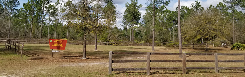
Long Branch Recreation Area offers horse trails ranging from 4 miles on the Blue Loop to 12 miles on the Yellow Loop. Adequate horse trailer parking and picnicking are also provided. There are restroom facilities a short distance from this recreation area.
Features
- Bicycling (prohibited on hiking trails)
- Hiking
- Horseback riding
- Picnicking
- Leashed pets allowed
Facilities
- Parking
- Restrooms (short distance away at North Fork Rec Area)
Directions
From County Road 217, take Long Branch Cemetery Road to recreation area on your left, approximately 1.5 miles.
North Fork Recreation Area
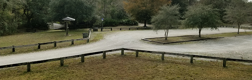
The North Fork Recreation Area offers visitors access to the North Fork of Black Creek for swimming and fishing. Adequate parking and picnicking areas are provided.
Features
- Fishing
- Hiking
- Picnicking
- Swimming (at your own risk)
- Leashed pets allowed
Facilities
- Grills
- Parking
- Pavilion
- Restrooms
Directions
From County Road 217, take Long Branch Cemetery Road to recreation area entrance on your right, approximately 2 miles.
Old Jennings Recreation Area
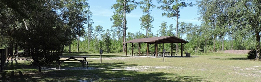
Old Jennings Recreation Area offers visitors ample parking and access to several different trail systems. The North Fork Black Creek Trail is a 5-mile hiking trail with a primitive camping zone located near the North Fork of Black Creek approximately halfway around the loop. The Longleaf Loop is a shorter 1.6-mile loop trail offering excellent views and a glimpse into the native longleaf pine forest ecosystem. The Bird Blind Loop is a half-mile loop offering a great viewing blind for bird-watchers. Horseback riders will find the Evans Horse Loops at this recreation area. The Blue Loop is 9 miles and the Yellow Loop is 16 miles.
Features
- Bicycling (prohibited on hiking trails)
- Hiking
- Hike-to camping
- Horseback riding
- Picnicking
- Leashed pets allowed
Facilities
- Camp zone (first come, first serve)
- Grills and picnic tables
- Interpretive display
- Parking
- Pavilion
- Restrooms
Trail Maps
-
Bird Blind Trail
[
361.3 kB
]
: 0.5 miles, easy
-
Longleaf Pine Trail
[
361.3 kB
]
: 1.6 miles, easy
-
North Fork Black Creek Trail
[
361.3 kB
]
: 5 miles, moderate
-
Evans Horse Loops
[
361.3 kB
]
: 9-16 miles
Directions
From State Road 21, take Old Jennings Road to Live Oak Lane and turn right. Follow to Old Jennings Recreation Area on left, approximately 1/4 mile.
Other Recreation Areas and Trailheads
-
Bell Cemetery Picnic Area
[
361.3 kB
]
-
Dunn's Farm Trailhead
[
361.3 kB
]
(Dunn's Camp Zone, Connector to Pioneer Trail): 3-10 miles, moderate
-
Fire and Water Nature Trail Trailhead
[
361.3 kB
]
: 1.75 miles, easy
-
Wildlife Viewing Tower
[
361.3 kB
]
Contact Us
Primary Contact:
Elizabeth Smith
(904) 406-6384
Elizabeth.Smith@FDACS.gov
Secondary Contact:
Justin Rogers
(904) 266-8361
Justin. Rogers@FDACS.gov
Jennings State Forest
1337 Long Horn Road
Middleburg, FL 32068


